News
New tool determines best projects to minimize flood risk
Climate Change, Flooding, Sound Rivers, Tar-Pamlico Watershed
Posted on January 15th, 2026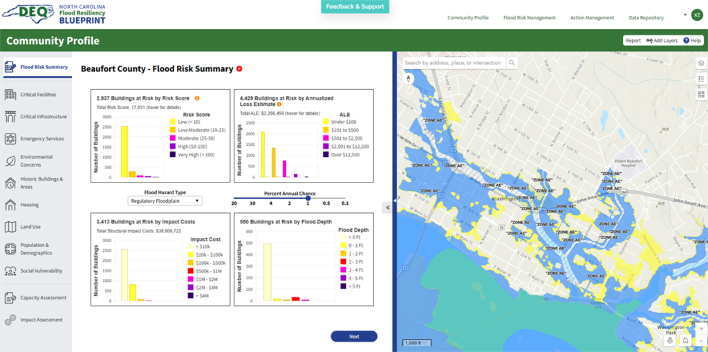
A screenshot of the new online flood resiliency tool from NCDEQ.
Pamlico-Tar Riverkeeper Katey Zimmerman met with North Carolina Department of Environmental Quality staff and stakeholders in flood resiliency this week to get a first look at new technology created to help mitigate flooding.
“Basically, this is an online, decision-making support tool, that consists of a series of map layers from data DEQ has collected to assess overall flood risk for communities,” Katey said. “You’re able to go into it, select a certain town/area of interest, analyze flood risk, then put together a plan to reduce the flood risk with different projects. So, it includes how to reduce flood risk and potentially help connect communities to sources of funding.”
Katey got an overview of the tool NCDEQ has rolled out as part of the North Carolina Flood Resiliency Blueprint, an effort to inform the state’s flood planning process to increase community flood resilience.
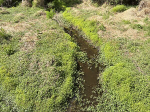
She said she floated the idea of incorporating projects included in a EPA grant application for the Jack’s Creek watershed in Washington — written in partnership with the City of Washington in December 2024 — into NCDEQ’s project list. Funding for the grant was rescinded in early 2025.
“Apparently, they’re making this blueprint tool from money designated by the General Assembly, and they’re looking for shovel-ready projects to fund,” Katey said.
Like the work your Riverkeeper is doing to find solutions for flooding issues? We do! Donate today to support resiliency!
Related News

Raleigh creek remains contaminated after sewage spill
May 28th 2026

Rocky Mount adds data-center rezoning to June 8 agenda
May 28th 2026

Sampling begins to identify septic “hot spots”
May 28th 2026

Runyon Creek open house nets good stormwater strategy
May 28th 2026
Sound Rivers investigates 1.1-million-gallon sewage spill
May 21st 2026

Sound Rivers welcomes 2026 interns
May 21st 2026
Clean Sweep, River Sweep lands 300-plus pounds of trash
May 21st 2026
Water Watch hits another milestone with Durham turnout
May 21st 2026