News
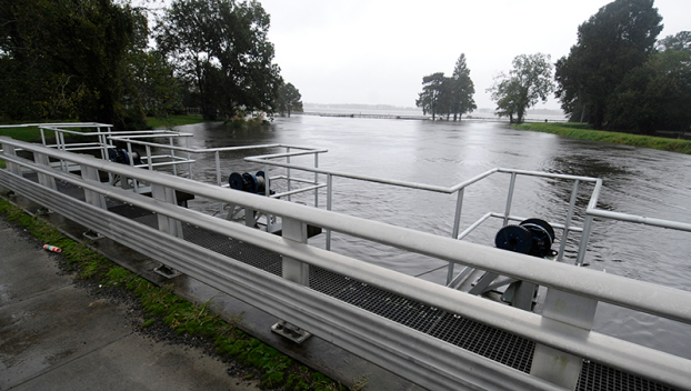
A partnership between the City of Washington, Mid-East Commission and Sound Rivers will map out future plans for Jack’s Creek, tackling both stormwater mapping, water quality and restoration of an urban stream.
Preliminary planning will be funded by a $15,000 grant from the North Carolina Department of Environmental Quality, which will pay for technical stormwater mapping and flood simulation models of the creek, both of which are essential to understanding the natural process of the Jack’s Creek, its flooding and the water-holding capacity of both the creek and its watershed, which includes most of the City of Washington.
“I’m excited about the project and just the idea of the partnership between all of us and the outcome being a restored Jack’s Creek,” said Jill Howell, Pamlico-Tar Riverkeeper.
According to Jamie Heath, a planner with Mid-East Commission, the grant will fund preliminary work, which will open doors to further funding.
“This is funding the background data, the gathering-all-the-data stage,” Heath said. “The next phase will be actually developing the plan.”
For Washington City Councilwoman Betsy Kane, the grant is a first step for a new look for Jack’s Creek.
“When we get the study finished from this grant, it will lay the ground for Jack’s Creek becoming a restored, urban stream so that ecologically, it is restored, and the pollutants are cleaned up or at least not getting worse,” Kane said. “I see an ecological restoration that also serves the urban needs of stormwater management and water quality improvement. We have this big area that is nothing but floodplains that the city has bought out and all we do is mow them.”
Kane, whose professional background is in urban planning, sees a future for Jack’s Creek that includes revegetation of its banks with aquatic vegetation and native plants, and introducing riffles and meanders to manage the flow of the water.
“It’s combining ecological restoration with stormwater management functions,” Kane said. “It could be a recreational amenity. It goes way back into Washington. There’s ditches that feed the creek — all those ditches that go behind houses and under the roads — all those little ditches are part of it, and drain the city. The recreational aspect: we’ve already got a little greenway out there, but we could extend the greenway and connect parks and neighborhoods.”
Kane said the plan could further involve public art and/or educational signs describing the history of the creek and the aquatic life and native species found there.
“I would love, 10 years from now, to see all this in place,” Kane said. “It could be a value center for water quality. It could be a value center for stormwater. It could be a value center for our neighborhoods.”
Related News
Neuse fish kill expected to extend beyond holiday weekend
July 3rd 2025
Swim Guide fails prompt Maple Cypress investigation
July 3rd 2025

Riverkeeper, town partners root out source of Smithfield sediment pollution
July 3rd 2025
Trash trap No. 12 approved for Smithfield
July 3rd 2025
Sunset River Paddle fundraiser boosts Water Quality Fund
July 3rd 2025

Riverkeepers host quarterly Water Watch meeting
July 3rd 2025
Public hearing will determine the fate of many NC wetlands
June 26th 2025
Clayton gets first official trash-trap cleanout
June 25th 2025
